Terrestrial Laser Scanning (TLS) Survey
Rapid and highly accurate 3D data capture using survey-grade laser scanning technology for terrain and structural modeling.
LiDAR Survey Ecosystem
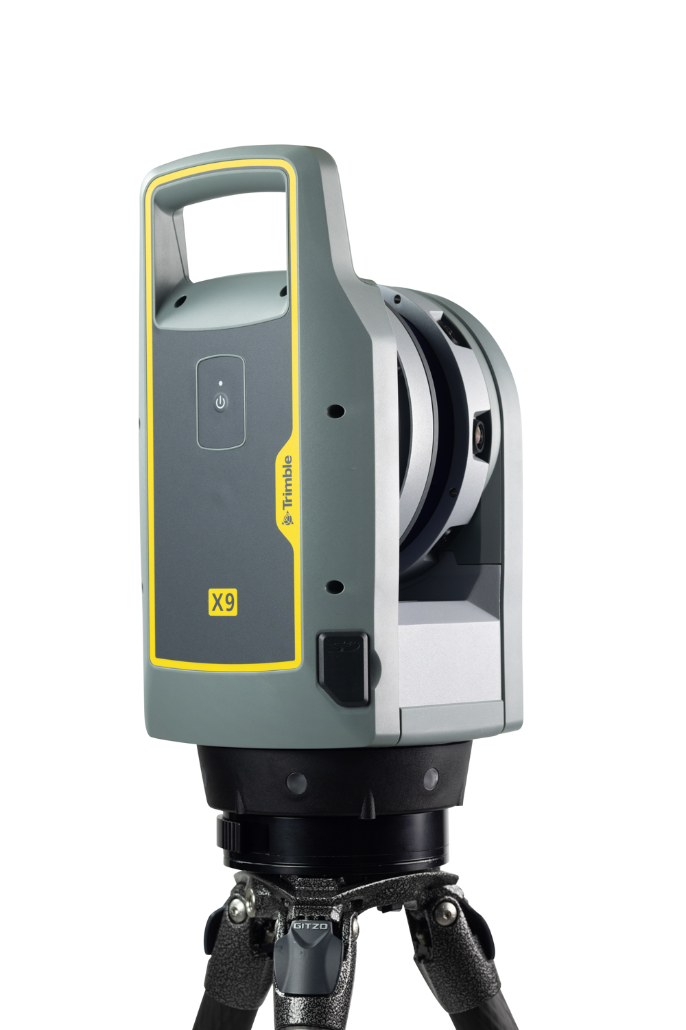
Trimble X9
A high-performance terrestrial laser scanner designed for rapid and accurate 3D data capture. The Trimble X9 records millions of spatial points using laser pulses to generate detailed point clouds.
Features automatic self-calibration, high-speed scanning, and integrated imaging for efficient and reliable field surveys. Captures terrain, structures, and infrastructure precisely.
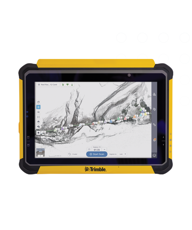
Trimble T110
A rugged field tablet used to control the laser scanner and manage survey operations. It connects wirelessly to the Trimble X9 for real-time monitoring.
Durable design and sunlight-readable display make it suitable for demanding outdoor environments like construction sites and mining areas.
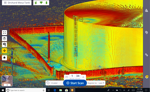
Trimble Perspective
Advanced field software for operating the Trimble X9 and managing scan workflows. Enables real-time visualization and automatic registration of scans in the field.
Ensures complete data coverage and allows seamless transfer of point cloud data for further processing and advanced 3D modeling.
Survey Methodology
The survey is conducted using the Trimble X9 3D Laser Scanner. During the survey, the scanner is placed at multiple locations around the site to capture overlapping scans. This technology allows precise documentation of structures, terrain, and engineering sites without direct physical contact. The rugged design of the T110 controller ensures reliable operation in harsh field environments such as construction sites and mining corridors.
Technical Capabilities
Field Operations Workflow
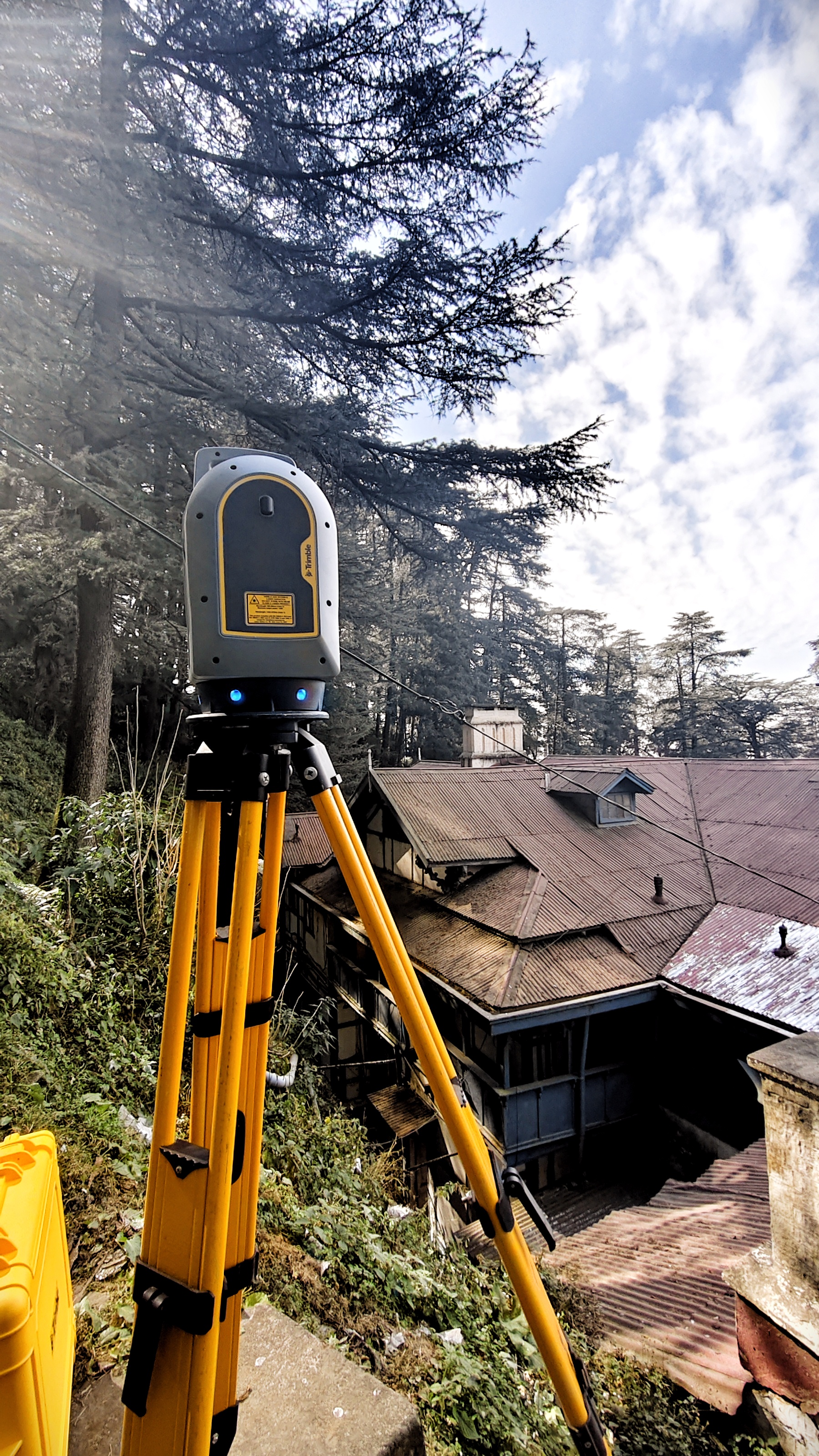
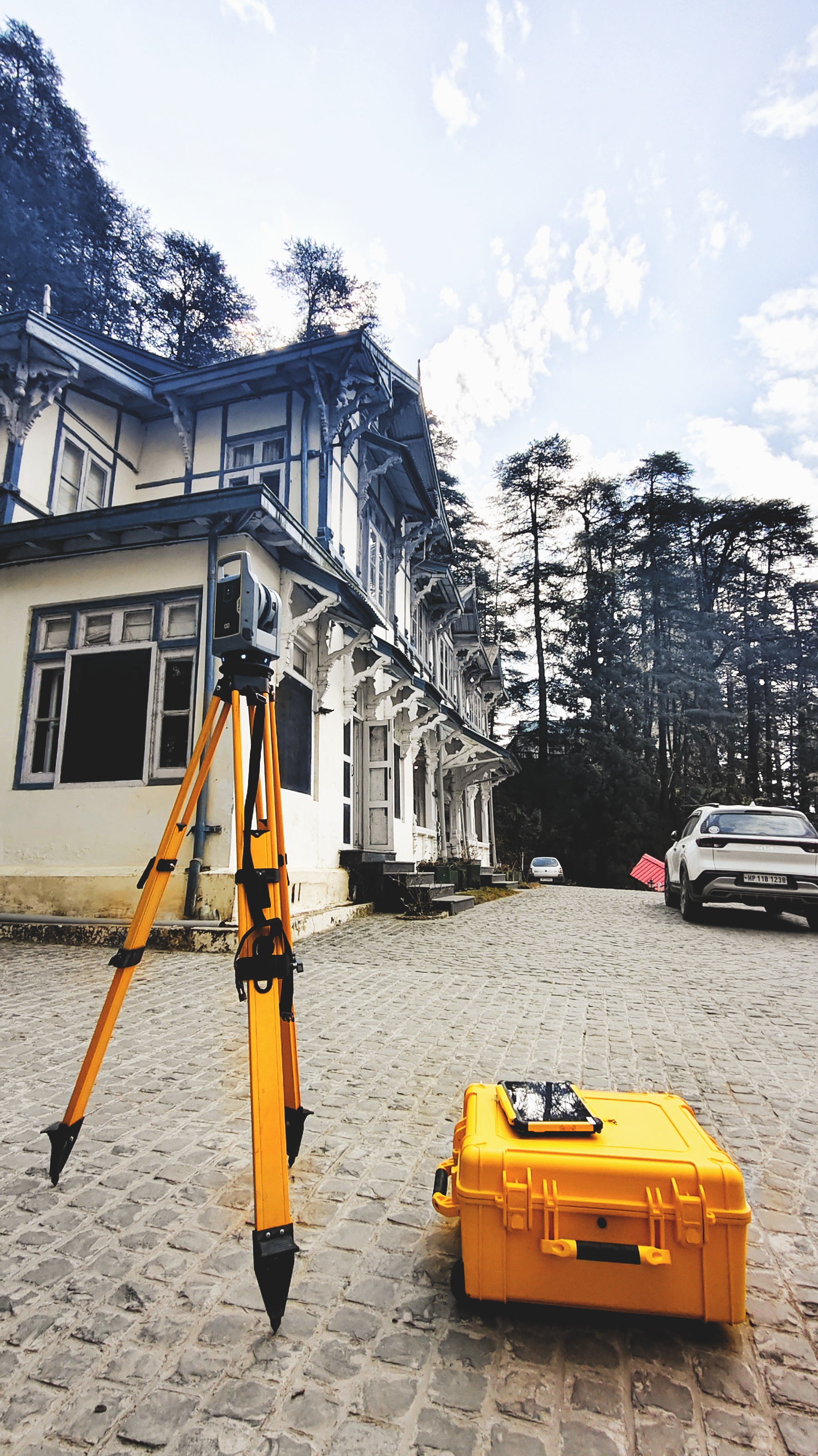
System Setup
TLS System setup and scanning the slope at Shimla, Himachal Pradesh.
Structural Survey
System setup and scanning of building architecture at Shimla, HP.
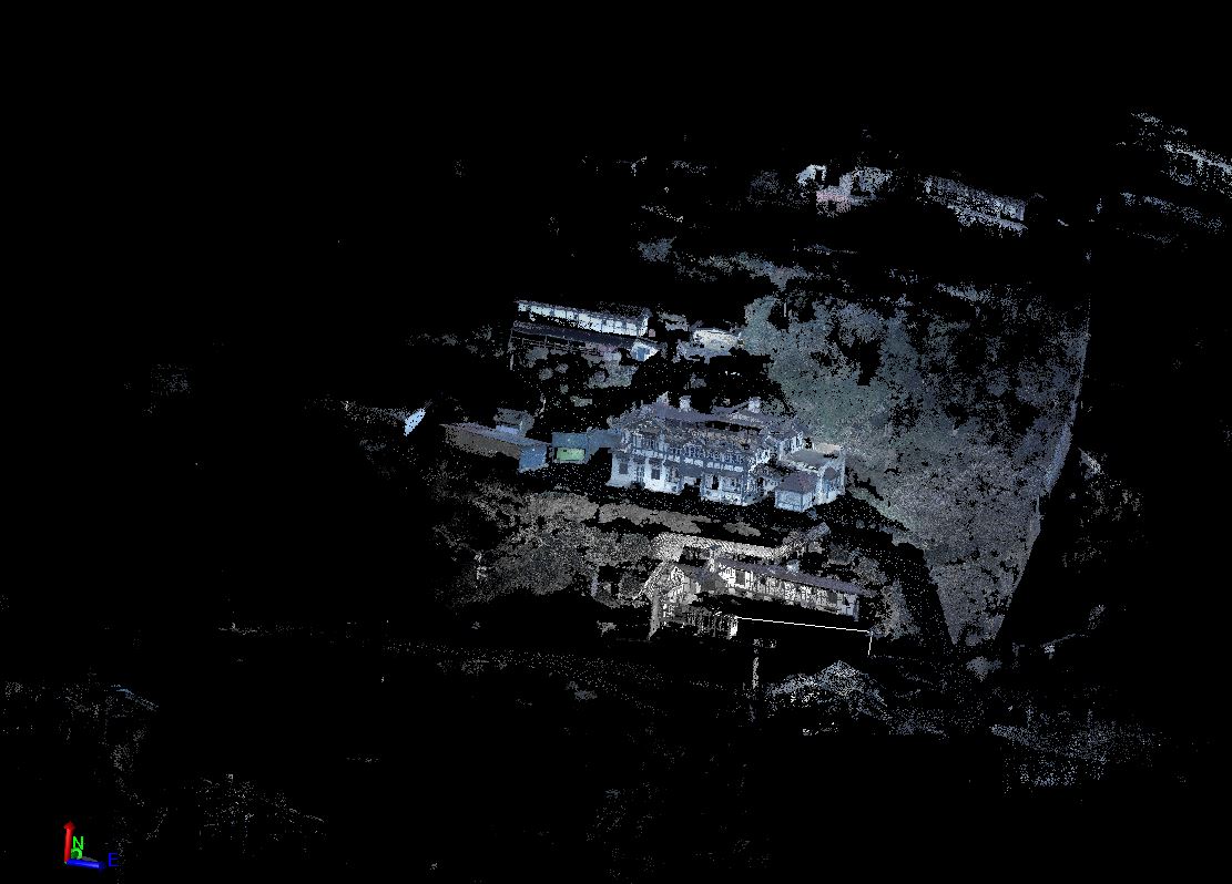
Point Cloud Generation
Initial point cloud generated for the scanned area showing raw spatial data.
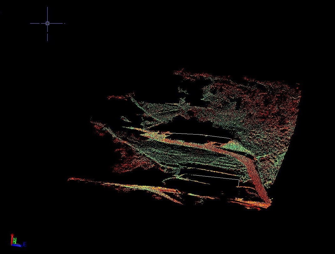
DTM Generation
Filtered point cloud processed for the generation of Digital Terrain Model (DTM).
Workshop & Training
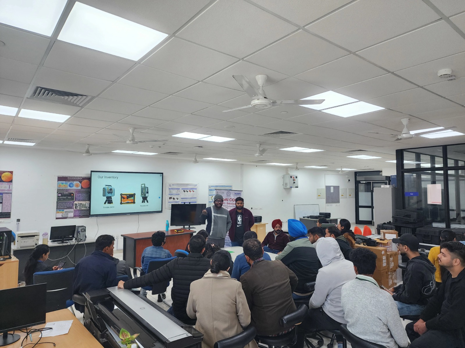
Modern 3D Surveying
Practical training in terrestrial laser scanning providing theoretical understanding of LiDAR technology.
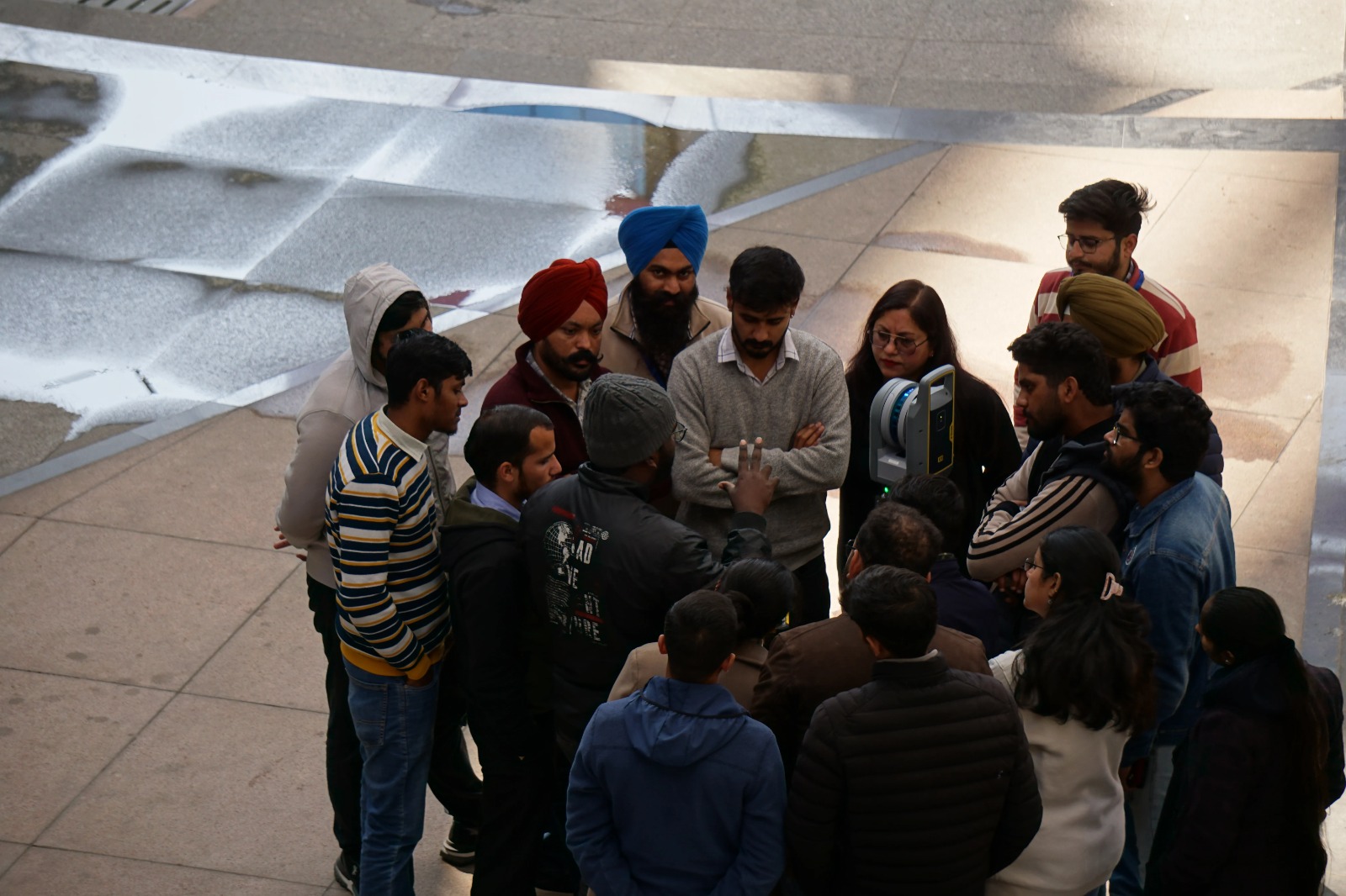
Field Deployment
Hands-on experience in modern 3D surveying technologies, including scan positioning and registration.
Service Applications
Frequently Asked Questions
Ready to Discuss Your Project?
Book a free consultation with our Terrestrial Laser Scanning experts and get professional insights tailored to your needs.
Book an Appointment