Drone Mapping & Surveying
Advanced aerial surveying methods using RTK-enabled UAVs for centimeter-level geospatial accuracy.
Survey Equipment Ecosystem
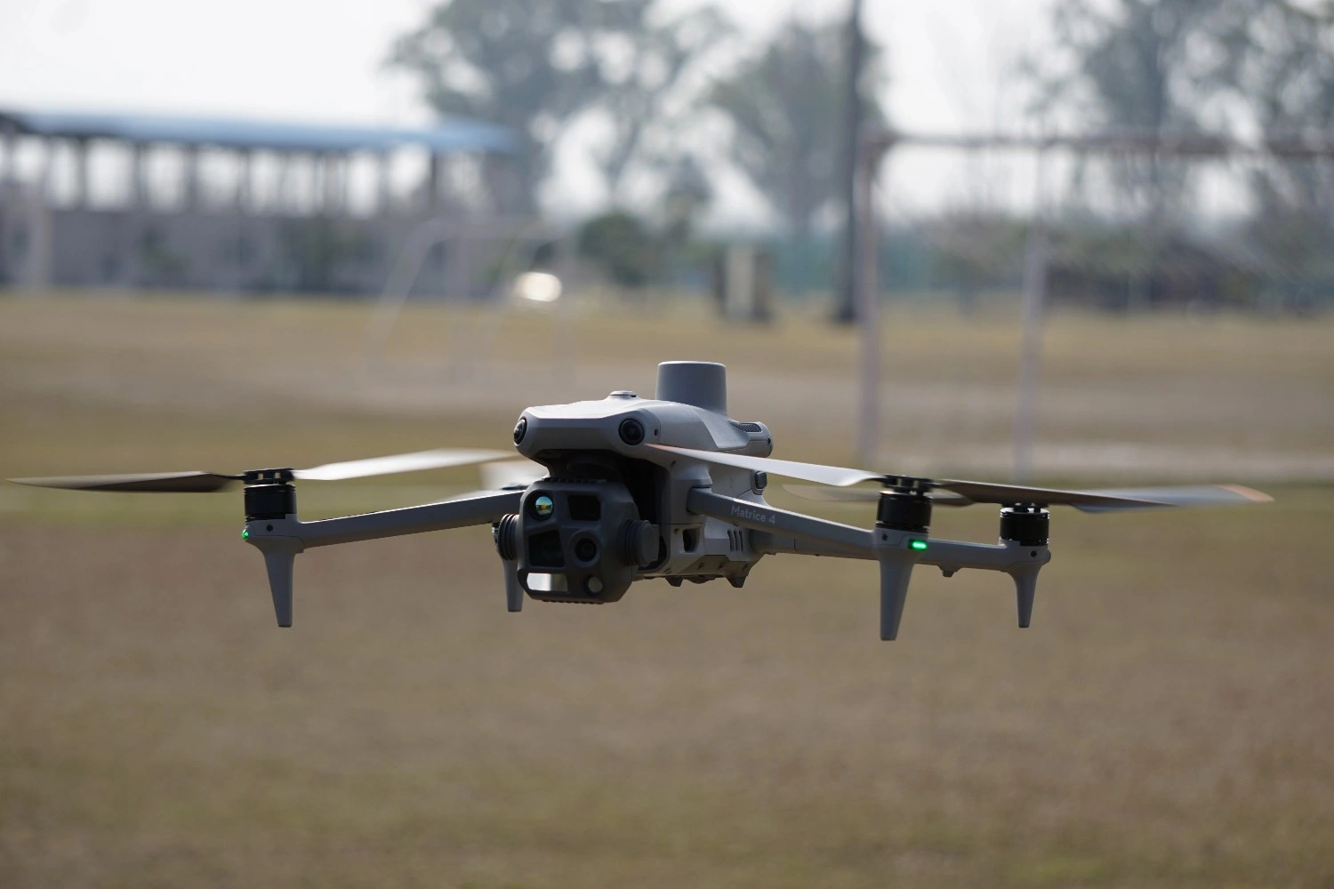
RTK Drone
Real Time Kinematic (RTK) Drone Survey is an advanced aerial surveying method that uses an unmanned aerial vehicle (UAV) equipped with an RTK-enabled GNSS receiver to capture highly accurate geospatial data. RTK technology improves the positional accuracy of drone data, allowing centimeter-level accuracy without the need for extensive ground control points.
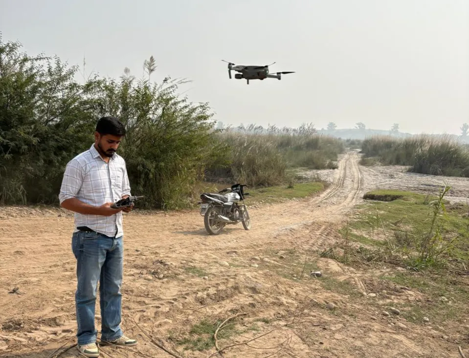
The drone equipped with a high-resolution camera and RTK GNSS receiver was used to capture aerial images in automatic flight mode.
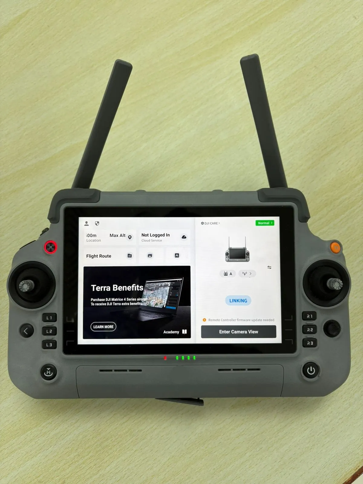
Remote Controller
The remote controller features a built-in high-brightness touchscreen display that allows the operator to monitor live video feed, flight status, satellite connection, RTK signal strength, and mission parameters in real time. The dual external antennas improve signal stability and ensure reliable data transmission, which is essential for RTK-based aerial surveying.
Multiple control buttons, joysticks, and customizable keys are provided on the controller for accurate drone navigation and camera control. The built-in battery indicator and status lights help monitor the power level during field operations, ensuring uninterrupted survey work.
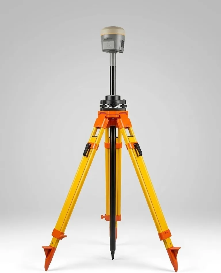
Base Station
The Base station continuously receives satellite signals from multiple GNSS constellations and transmits correction data to the drone controller. These corrections reduce positioning errors caused by atmospheric disturbances and satellite inaccuracies, allowing the drone to achieve centimeter-level accuracy.
The use of an RTK base station improves the overall precision of aerial survey data and reduces the need for multiple ground control points. This ensures reliable results for topographic mapping, volume calculation, construction survey, and GIS applications.
RTK Drone Survey Excellence
The survey of the project area was carried out using an RTK-enabled drone system consisting of a drone, remote controller, and GNSS RTK base station to achieve high-precision results. Our drone, equipped with a high-resolution camera and RTK GNSS receiver, captures georeferenced aerial images in automatic flight mode, ensuring reliable data collection for complex engineering and GIS mapping projects.
The drone was operated using a professional remote controller with a built-in display, which allowed real-time monitoring of flight status, satellite connection, and RTK signal during the survey. An RTK base station was installed on a stable location to provide real-time correction data to the drone, which improved positional accuracy to centimeter level. With the help of RTK correction, the drone captured accurate georeferenced images, which were processed using photogrammetry software to generate Orthomosaic, DEM, DSM, and contour data in the required coordinate system and datum.
Technical Capabilities
Field Operations Workflow
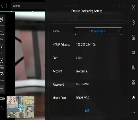
Network Connection
Internet connection was established in the remote controller to receive RTK correction signals from the CORS network for high-accuracy positioning.
Mission Planning
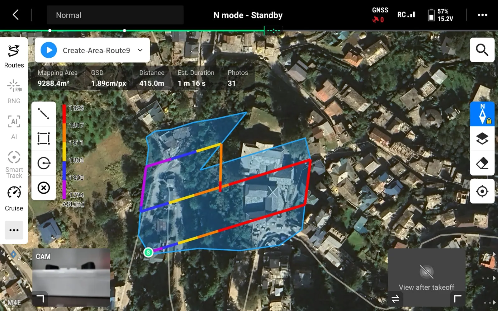
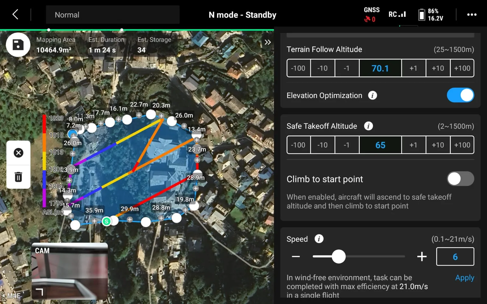
The survey area was checked and the flight mission was planned in automatic grid mode using mission planning software.
Pre-flight Verification
Before takeoff, RTK status, satellite count, network connection, speed, overlap % and battery levels were verified to ensure proper accuracy.
Data Acquisition
The drone was flown over the project area to capture high-resolution images with required overlap, while continuously receiving correction data from the network base station.
Workshop & Practical Training
.jpg)
Classroom Session
An interactive classroom session demonstrating Drone surveying principles, equipment operation, and real-time data processing techniques for high-precision geospatial applications.
.jpg)
Hands-on Demo
Hands-on demonstration of RTK drone survey equipment was conducted to show the setup, operation, and real-time data acquisition using drone, controller, and Network CORS correction system.
.jpg)
Field Training
Field training on RTK drone surveying was conducted to provide practical knowledge on drone setup, mission planning, Network CORS connection, and accurate aerial data collection.
.jpg)
Data Processing
Drone data processing and surface modeling were performed to generate accurate orthomosaic, DEM, DSM, and contour data using photogrammetry software from captured aerial images.
Industry Applications
Common Questions
Ready to Discuss Your Project?
Book a free consultation with our Drone Survey experts and get professional insights tailored to your needs.
Book an Appointment